El Paso Area RR Maps
1. List of Maps
Southern Pacific Rio Grande Division May 12, 1950
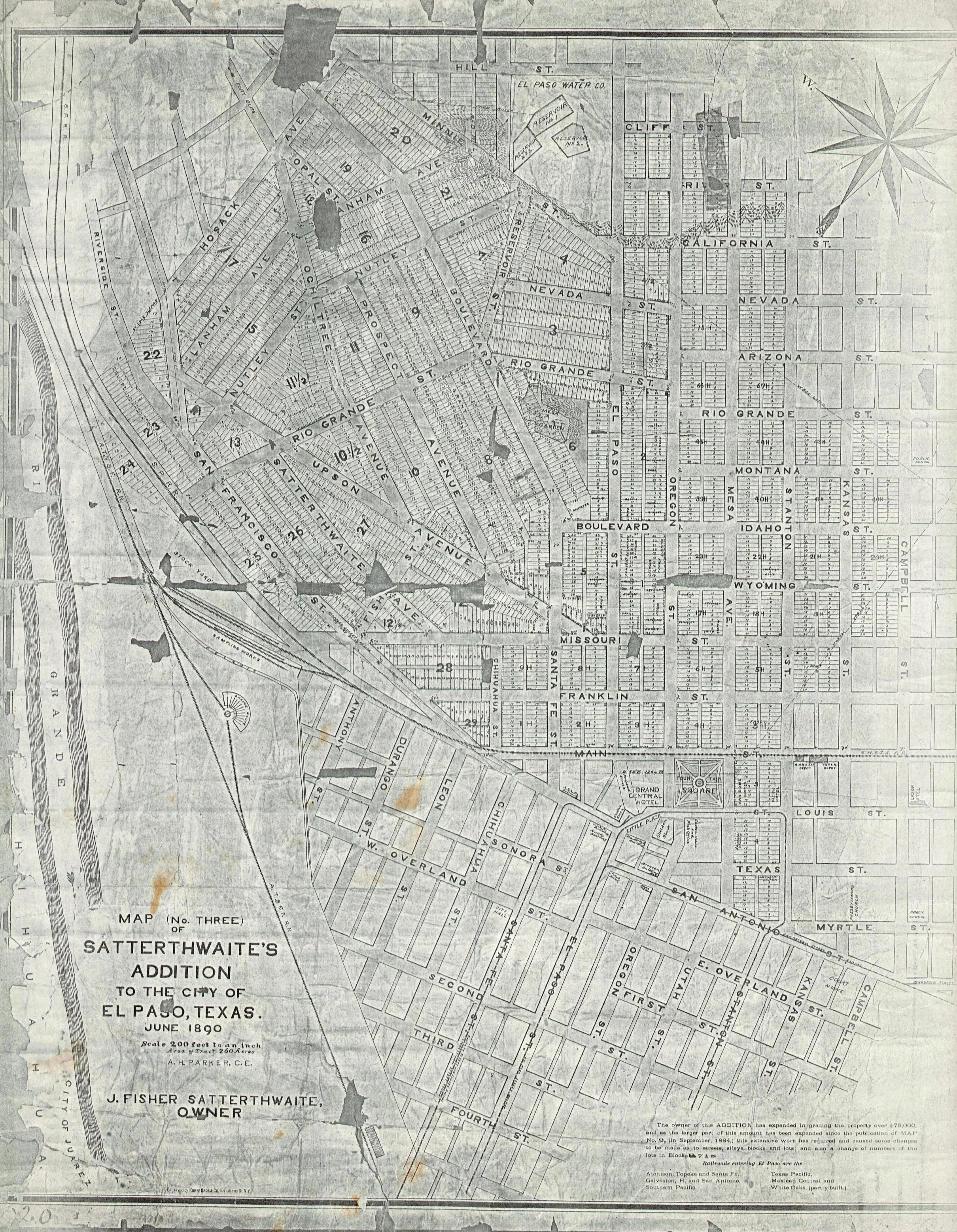
June 1890 Shatterwaite’s map of El Paso
Southern Pacific Rio Grande Division May 12, 1950
First Item posted is the complete drawing. Then the following subections are of the drawin are cropped and posted.
Sub sections
A. Union Depot Area
B. Bataan Trainway Section
C. Yard Section (Dallas Street)
D. Tower 47
E. Shop Yard
F. Drawing Title

Union Depot
This is the left side of the drawing. The depot is shoe horned into the remaining space. The west end of the Union Depot Yard is an insert. at the bottom. Notice Davis St. was hand drawn in. The tracks that do not exists are dotted. They could be already removed or yet to be installed.

Battan Trainway Section

Yard Section.
Apart of the May 12, 1950 map is this section which provides a description on the different yard destinations. A and B yards were originally constructed by the El Paso & Southwestern. Yards C and D were the oldest part of the yard constructed by the Southern Pacific/Galveston, Harrisburg & San Antonio. E Yard is the yard the El Paso & Northeastern originally constructed. The ACME fast freighthouse is the former El Paso & Southwestern freighthouse. There was a locomotive shop for the Galveston, Harrisburg & San Antonio east of Kansas Street and between the El Paso & Southwestern Freighthouse and the Southern Pacific freighthouse in yard F. The ice dock is almost complete. The ice dock was installed after WWII. After the Bataan Trainway is completed, the Ice dock will be completed. The ice dock was removed in the early 1970s.

Tower 47.
Placed into operation on Saturday July 9, 1904. Tower 47 managed the traffic between the Galveston Harrisburg & San Antonio Railroad, the Texas & Pacific Railway, and the El Paso & Northeastern Railway. With the construction of the Cotton Street overpass underway there are a couple of track realignments at Tower 47.

Shop Yard.

Drawing Title.
The Purchase of the El Paso & Southwesten has changed the influence for the Southern Pacific from the Atlantic Lines to the Pacific Lines.

This June 1890 Shatterwaite’s map of El Paso provides us an idea of what was at the Union Depot Site prior to the Construction of El Paso Union Depot. This map also has some of El Paso’s imfamous street names before the self respecting individuals decided to address the issues associated with the stigma of some of the nearby establishments by completely changing street names. The list of railroads entering the city includes the White Oaks line which at this time about 10 miles of track had been laid before fundin disapeared. At this time the Eddy Brothers were not involved.